|
A
A
A
|
Home
|
Login
|
Your Cart
|
Checkout
|
Contact
Search Products
Products
New Products
Tourist Products
Map Bundles
National Park, Walk & Recreation Maps
1:50 000 Topographic Maps
1:250 000 Topographic Maps
National Park, Walk & Recreation Digital Maps
1:25 000 Digital Products
1:50 000 Digital Products
1:100 000 Digital Products
1:250 000 Digital Products
Administration and Tenure Maps
1:25 000 Topographic/Cadastral Maps
1:100 000 Topographic Maps
Wall Maps and Posters
Free Map Products
Historical Charts
Historical Maps
TASMAP on Facebook
All Products
Home
>
1:25 000 Topographic/Cadastral Maps
The 1:25,000 Topographic/Cadastral mapping series has been archived following the introduction of the 1:50,000 Topographic mapping series in 2015.
The 1:25 000 Topographic/Cadastral Map Series portray highly detailed topographic information such as roads, rivers, lakes, vegetation and relief. Also shown is cadastral data, Local Government Area boundaries and locality boundaries which makes these maps invaluable for property related searching. The Land Parcel Identifiers (LPI) give a quick visual reference to individual properties over 2 hectares in size and link to the Property, Valuation and Title databases via the LIST website.
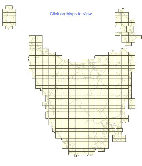
The Series covers the entire State with 415 maps. Each map covers a 10 x 20 kilometre area with a 1 kilometre grid based on the Universal Transverse Mercator projection (UTM). At this scale, 1 millimetre on the map represents 25 metres on the ground. Since 2003 these maps have been produced on the Map Grid of Australia (MGA94) which utilises the Geocentric Datum of Australia 1994 (GDA94). GDA94 maps have an overlapping bleed edge on the northern and eastern sides. This extension fills the gap between the older Australian Map Grid 1966 (AMG66) / Australian Geodetic Datum 1966 (AGD66) maps and the new maps on the GDA94 datum.
414 items in
1:25 000 Topographic/Cadastral Maps
1
|
2
|
3
|
4
|
5
|
6
| 7 |
8
|
9
Code
Name
Price
Buy
3249
Robbins 1:25000 Topographic/Cadastral Map
AUD9.95
3252
Rochon 1:25000 Topographic/Cadastral Map
AUD9.95
3647
Rocky Cape 1:25000 Topographic/Cadastral Map
AUD9.95
3245
Roger 1:25000 Topographic/Cadastral Map
AUD9.95
4024
Rookery 1:25000 Topographic/Cadastral Map
AUD9.95
3637
Rosebery 1:25000 Topographic/Cadastral Map
AUD9.95
5434
Ross 1:25000 Topographic/Cadastral Map
AUD9.95
5638
Rossarden 1:25000 Topographic/Cadastral Map
AUD9.95
4237
Rowallan 1:25000 Topographic/Cadastral Map
AUD9.95
5631
Royalty 1:25000 Topographic/Cadastral Map
AUD9.95
5636
Roys 1:25000 Topographic/Cadastral Map
AUD9.95
4233POD
Rufus 1:25000 Topographic/Cadastral Map
PRINT ON DEMAND ONLY
AUD55.00
4220
Rugby 1:25000 Topographic/Cadastral Map
AUD9.95
5427
Runnymede 1:25000 Topographic/Cadastral Map
AUD9.95
5641
Saddleback 1:25000 Topographic/Cadastral Map
AUD9.95
2459
Saltwater 1:25000 Topographic/Cadastral Map
AUD9.95
5627
Sandspit 1:25000 Topographic/Cadastral Map
AUD9.95
3630
Sarah 1:25000 Topographic/Cadastral Map
AUD9.95
3440
Savage River 1:25000 Topographic/Cadastral Map
AUD9.95
6040
Scamander 1:25000 Topographic/Cadastral Map
AUD9.95
6031
Schouten 1:25000 Topographic/Cadastral Map
AUD9.95
4423POD
Scotts 1:25000 Topographic/Cadastral Map
PRINT ON DEMAND ONLY
AUD55.00
5444
Scottsdale 1:25000 Topographic/Cadastral Map
AUD9.95
2458
Sea Elephant 1:25000 Topographic/Cadastral Map
AUD9.95
3836
Selina 1:25000 Topographic/Cadastral Map
AUD9.95
6056
Sellars 1:25000 Topographic/Cadastral Map
AUD9.95
4026
Serpentine 1:25000 Topographic/Cadastral Map
AUD9.95
4021
Settlement 1:25000 Topographic/Cadastral Map
AUD9.95
4441
Sheffield 1:25000 Topographic/Cadastral Map
AUD9.95
5760
Sister 1:25000 Topographic/Cadastral Map
AUD9.95
4625
Skeleton 1:25000 Topographic/Cadastral Map
AUD9.95
3447
Smithton 1:25000 Topographic/Cadastral Map
AUD9.95
5635
Snow 1:25000 Topographic/Cadastral Map
AUD9.95
4224
Solitary 1:25000 Topographic/Cadastral Map
AUD9.95
5426
Sorell 1:25000 Topographic/Cadastral Map
AUD9.95
4229
Spires 1:25000 Topographic/Cadastral Map
AUD9.95
4636POD
Split Rock 1:25000 Topographic/Cadastral Map
PRINT ON DEMAND ONLY
AUD55.00
5443
Springfield 1:25000 Topographic/Cadastral Map
AUD9.95
5844
Spurrs Rivulet 1:25000 Topographic/Cadastral Map
AUD9.95
6042
St Helens 1:25000 Topographic/Cadastral Map
AUD9.95
5837
St John 1:25000 Topographic/Cadastral Map
AUD9.95
5839
St Marys 1:25000 Topographic/Cadastral Map
AUD9.95
5637
St Pauls Dome 1:25000 Topographic/Cadastral Map
AUD9.95
5439POD
Stacks 1:25000 Topographic/Cadastral Map
PRINT ON DEMAND ONLY
AUD55.00
5438
Stanhope 1:25000 Topographic/Cadastral Map
AUD9.95
3448
Stanley 1:25000 Topographic/Cadastral Map
AUD9.95
4833
Steppes 1:25000 Topographic/Cadastral Map
AUD9.95
2355
Stokes 1:25000 Topographic/Cadastral Map
AUD9.95
5230
Stonor 1:25000 Topographic/Cadastral Map
AUD9.95
4044
Stowport 1:25000 Topographic/Cadastral Map
AUD9.95
1
|
2
|
3
|
4
|
5
|
6
| 7 |
8
|
9